Street Signal

Rogers.

New-build suburban, family-coded, mall and office park anchored. The most predictable of the five.

Imagery Esri / Maxar

Last updated · May 18, 2026

Quick read

The four signals to know first.

  • Local Authenticity Medium
  • Tourism Saturation Low
  • Walkability Low
  • Remote Work Viability Medium

See all twelve ↓

Places we read

The corners we keep returning to.

Three places that tell you what Rogers is right now — who is on the sidewalk at what hour, what the air smells like, what changes between Wednesday morning and Saturday night. We come back to each one regularly.

Pinnacle Hills Promenade, Rogers · Wikimedia Commons (CC)

01 market

Pinnacle Hills Promenade

“Suburban retail done well — but it is retail.”

Best · Saturday afternoon walked May 17, 2026
Read our full note ↓

Pinnacle Hills Promenade is the open-air shopping center that anchors west Rogers — Apple Store, lululemon, J. Crew, an Onyx Coffee Lab outpost, a half-dozen restaurants, the Malco theatre. On a Saturday afternoon the sidewalks are full and the parking lots are fuller. Foot traffic skews family, with a steady stream of cyclists from the connected Greenway spur.

The honest read: this is a shopping center, designed and operated as one. The architecture is good for the category — brick, parking around back, walkable interior. It is still a shopping center. If you want a daily-life walkable amenity, this is not it. If you want a Sunday-afternoon errand corridor with parking and a movie theatre, this is the best version of that in NWA.
Walmart AMP, Rogers · Wikimedia Commons (CC)

02 plaza

Walmart AMP

“On show nights the parking lot is the second venue.”

Best · Concert nights, gates at 6pm walked May 17, 2026
Read our full note ↓

The Walmart AMP is the open-air amphitheatre that hosts the biggest touring shows in NWA — a few dozen evenings a year drawing close to its capacity of around ten thousand people. On a show night the parking starts filling at 5pm, the Promenade restaurants run a turnover wait by 6, and the lawn fills by sunset. We have walked it on a country tour stop and on a midweek jazz night. Both readings are honest.

The trade-off for nearby residential: the sound. On a still summer evening the bass from the main stage carries half a mile into Pinnacle Hills. If you are buying within a 12-minute walk of the AMP, look at the season calendar before you commit. The off-season silence is real, and so is the late-September Friday cheer.

corner

Photo pending capture

36.3315°N · 94.1158°W

See on Google Maps →
We have not yet captured a photo of this place we would stand behind.

03 corner

Downtown Rogers · First Street

“Frisco-era brick that survived the highway-bypass wave.”

Best · Friday late afternoon walked May 17, 2026
Read our full note ↓

First Street in downtown Rogers is two blocks of original Frisco-railroad-era brick storefronts that escaped the strip-mall era because Rogers grew west instead of through them. There is a small brewery here, a coffee shop that has been there twelve years, the Daisy Airgun Museum, and an antique store that doubles as the unofficial town living room.

On a Friday at 5pm the block is the quiet version of busy — people parking, walking, holding a conversation on the sidewalk that they have probably had before. Compared to Bentonville Square this is a smaller stage with a smaller cast. That is the appeal, and it is also the limitation. We tell buyers who want walkable Rogers that this corridor is the only walkable Rogers, and it is two blocks long.

overlook

Photo pending capture

36.3374°N · 94.0994°W

See on Google Maps →
We have not yet captured a photo of this place we would stand behind.

04 overlook

Lake Atalanta

“The lake older Rogers built itself around, before the mall pulled the center west.”

Best · Sunday morning walked May 17, 2026
Read our full note ↓

Lake Atalanta is the 32-acre lake on the east edge of old downtown Rogers, with a 3.5-mile paved loop trail and a connected mountain-bike network running into the bluffs. On a Sunday morning at 8am the loop is locals walking dogs, a few stroller-pushing families, and cyclists clipping past on the way to the Back 40 trailhead.

For a buyer profiling Rogers, the east-side residential blocks near Atalanta are the quietest version of the town — older infrastructure than Pinnacle Hills, lower price floor, and walking-distance access to a trail network the newer-build buyers have to drive to. The trade-off is that the school zoning here can shift block by block; verify the elementary zone before you write an offer.

overlook

Photo pending capture

36.3087°N · 94.1834°W

See on Google Maps →
We have not yet captured a photo of this place we would stand behind.

05 overlook

Mercy Park

“The most-used park in NWA you have never heard of.”

Best · Weekday early morning walked May 17, 2026
Read our full note ↓

Mercy Park is the playground-and-trail complex on the west side of Rogers, anchored by Mercy Hospital and used heavily by the families in the surrounding new-build neighborhoods. On a weekday at 7am the trails are full of pre-work walkers, the playground starts filling around 9, and the parking is rarely a problem. The hospital itself sits at the south edge — visible, audible at certain hours, and a structural reason for why west Rogers values have been steady.

For a buyer with school-age kids prioritizing playground-and-trail walkability without giving up the Rogers school zone, the streets within a six-minute walk of Mercy Park are the right shortlist. Verify Cox fiber per address — the build-out is uneven a block off the main arterials.

Texture

How it feels at this hour.

Rogers wakes up in a garage. The first sound on a Pinnacle Hills morning is a Lexus SUV or a Tundra backing onto a cul-de-sac, the driver headed to one of three office parks within a six-minute drive. By 7:30 the Onyx satellite at the Promenade has a line of mostly familiar regulars. By 9 the parking lots are full and the streets are empty — the inverse of how a college town wakes.

Old downtown Rogers, four miles east, runs on a different clock. Brick storefronts along First Street, a small daily-newspaper office, the Daisy Airgun Museum, an antique store that has been there since 1981. On a Wednesday morning at 10 it reads as a small Arkansas town that survived the highway-bypass era because it knew how to. If you wake up in Pinnacle Hills you will hear lawn equipment. If you wake up downtown you will hear the train. Both are Rogers. Most buyers pick one without knowing the other exists.

Trajectory

Where this is heading.

Confidence

Rogers is the most absorbed of the five towns — the Walmart-driven growth wave landed here as fully as anywhere in NWA over the last decade, and the new-build inventory is now mature rather than emerging. Pinnacle Hills will continue to be the predictable suburban product. Old downtown is in the early phase of a brewery-and-restaurant revival that will play out over the next five to seven years if it plays out at all.

Two specific dials we are watching. Mercy Hospital's continued expansion on the west side anchors a healthcare-economy floor under west Rogers values. The Walmart AMP's programming becomes more or less aggressive each season, which moves noise-profile readings for the adjacent residential blocks meaningfully. Buy in Rogers for school zone, predictable commute, and stable comps. Do not buy in Rogers expecting Bentonville's cultural curve to spill south.

Inside Rogers

3 sub-neighborhoods, each a different product.

Most relocators pick a town and stop. The sub-area within the town is the actual residential decision.

  1. 01 $$$ — $500K to $850K typical

    Pinnacle Hills + Promenade corridor

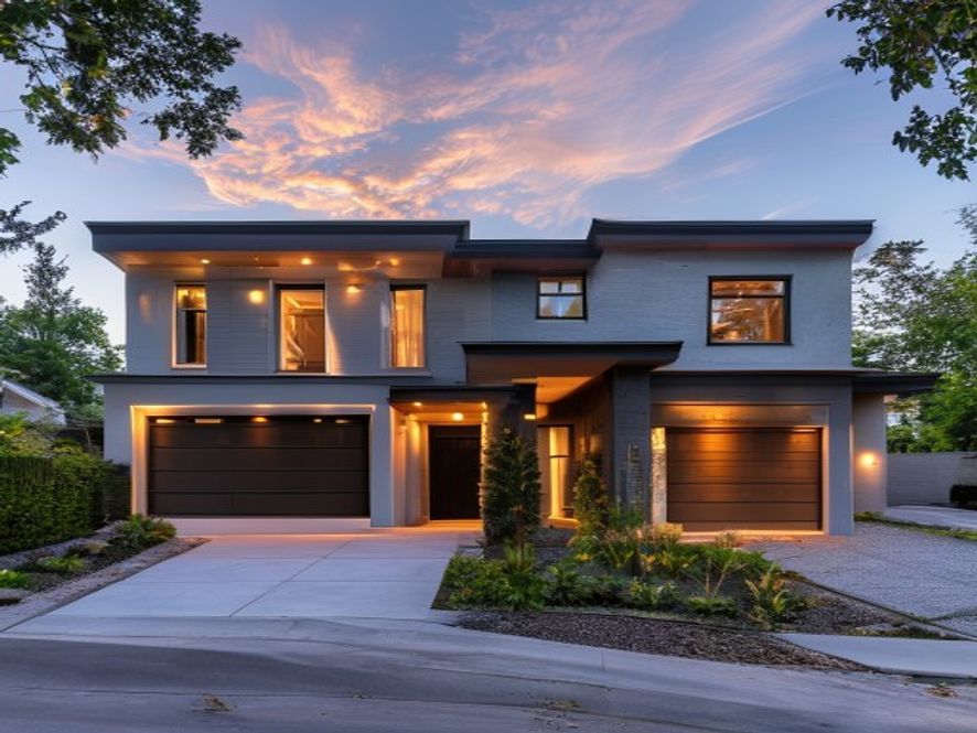
    New-build single-family west of I-49 anchored by Pinnacle Hills Promenade and the Mercy Hospital expansion. Family-coded, school-district stable, the most predictable Rogers product.

    Best for

    Family with school-age kids, hybrid-office commuter, buyer who wants new build with no maintenance backlog.

    Trade-off

    Cultural density is the lowest in NWA by design. Walkability is essentially zero. The AMP concert noise reaches the east edge of this sub-area on still summer nights.

  2. 02 $ — $275K to $475K typical

    Lake Atalanta + east Rogers

    Older single-family on the east side of I-49, anchored by Lake Atalanta's 32-acre lake and connected trail network. Lower density, older infrastructure, and walking-distance access to the Frisco-era downtown.

    Best for

    Buyer who wants Rogers school zone + trail access at a lower price floor than Pinnacle Hills.

    Trade-off

    Older infrastructure (1970s and 1980s build dates dominate). School zoning can shift block by block — verify the elementary line.

  3. 03 $$ — $400K to $625K typical

    Mercy Hospital corridor

    Newer-build family residential anchored by Mercy Park's playground-and-trail complex and the hospital itself. Steady values, healthcare-economy floor, family-dense.

    Best for

    Healthcare worker, retiree wanting hospital proximity, family prioritizing playground walkability.

    Trade-off

    Hospital traffic and helipad activity audible from some addresses. Cox fiber build-out is uneven block-to-block.

Beyond Rogers

Hidden gems within a short drive.

Caves, battlefields, working mills, conservation areas. The corners of the region most Rogers residents have driven past without stopping.

Hobbs State Park · Conservation Area
Bridge to Van Winkle grounds, Hobbs SP · Wikimedia Commons (CC)

natural-area · 32 min drive

Hobbs State Park · Conservation Area

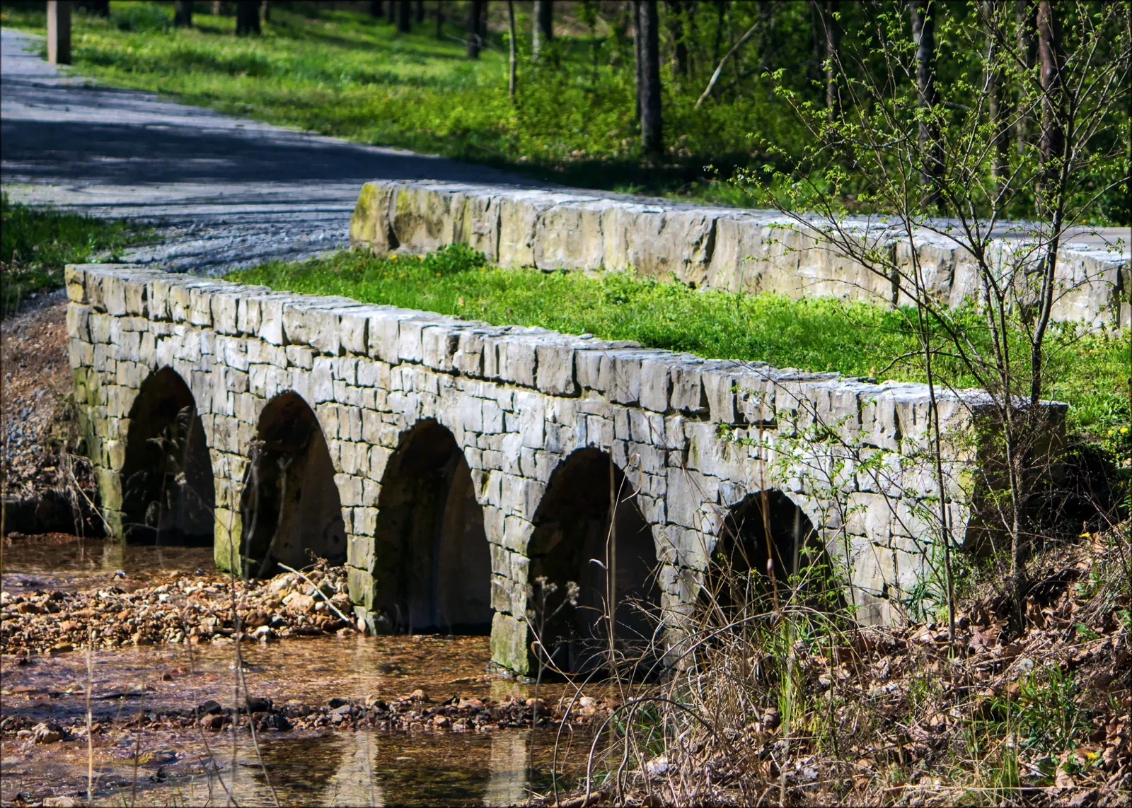
The 12,000-acre state park most NWA residents have driven past on the way to Eureka Springs without ever stopping.

Beaver Lake-adjacent woodlands with twenty miles of trail, the historic Van Winkle homestead, and the only Conservation Area in the Arkansas State Parks system. Free entry. The Sinking Stream Cave is accessible by guided tour seasonally — check the visitor center for the schedule. Wednesday and Thursday mornings are when the locals walk; weekends pull a heavier crowd.

See on Google Maps →

War Eagle Mill
War Eagle Mill · Wikimedia Commons (CC)

mill · 35 min drive

War Eagle Mill

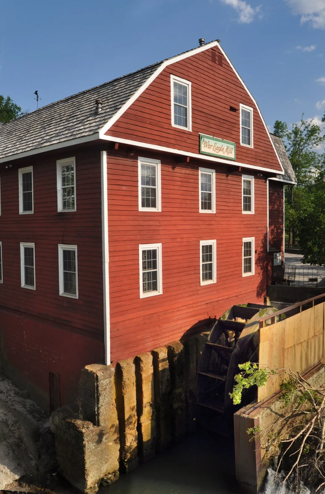
A working grist mill on a covered bridge over the War Eagle River, twenty minutes east of Rogers. Open six days a week, ground stone-milled flour on site.

Three-story 1973 reconstruction of the 1832 original — the only working water-powered gristmill in Arkansas. Buy the cornmeal, eat at the second-floor restaurant, walk the covered bridge. Twice a year (May and October) the Mill hosts the War Eagle Craft Fair which is a different and much busier experience. Weekday afternoons are the quiet read.

See on Google Maps →

cave

cave · 23 min drive

War Eagle Cavern on Beaver Lake

The only cave in Arkansas with a lakeside entrance — opened on a bluff directly above Beaver Lake — that most NWA residents have driven past on Highway 12 for years without stopping.

Address is 21494 Cavern Dr, Rogers AR 72756, half a mile off US-12 between Rogers and Eureka Springs. Open daily March through Thanksgiving weekend, 9:30am–5pm; guided tours run approximately one hour. Adult tickets in the $15–20 range; check wareaglecavern.com for current pricing. The paved bluff path to the entrance ends at Eagle Point, a 40-foot overlook over the cove — worth the trip alone. Arrive at opening to get the first tour before summer humidity builds inside. Gem panning is genuinely fun for kids and not upsold aggressively.

See on Google Maps →

battlefield

battlefield · 2 min drive

Rogers Historical Museum

A free, three-building campus in downtown Rogers with a working apple orchard and rotating exhibits on Ozark life from 1800s pioneer settlement through the poultry industry — the kind of place that turns a 20-minute stop into two hours.

Address is 313 S. 2nd St, Rogers AR 72756, at the corner of 2nd and Cherry in historic downtown. Open Tuesday through Saturday, 10am–4pm; free admission. The Hawkins House offers guided tours of a preserved Victorian-era home on the campus. The apple orchard out back is a working period-accurate feature, not decorative. The museum's Beaver Lake history archive (photographs, original land surveys, pre-impoundment farm records) is the best primary source on the valley before it was flooded in 1964. Visit on a Tuesday when school groups are minimal.

See on Google Maps →

lookout

lookout · 20 min drive

Scenic Highway 12 Beaver Lake Pullouts

A state highway that doubles as one of the best lake-bluff drives in the Ozarks, with unsigned gravel pullouts offering direct views over Beaver Lake's blue-green arms — locals use it as a Sunday drive, visitors miss it entirely.

Drive west from Rogers on AR-12 toward Eureka Springs; the most dramatic lake views begin around mile marker 18–22 where the road runs along the bluff edge. No facilities, no fee. The unsigned dirt pullouts on the south side of the road are stable in dry weather; avoid after heavy rain. Best light is morning when the water reflects before afternoon chop builds. Pairs naturally with a stop at War Eagle Cavern (same highway) or War Eagle Mill further east. Full round-trip from Rogers is under 90 minutes.

See on Google Maps →

Full read

Twelve signals.

Each banded. Each with a confidence dot. How we score →

Street Signal

How we score →
  • Local Authenticity

    Old downtown Rogers — the Frisco-era brick blocks around First Street — has authentic roots. Pinnacle Hills and the Promenade corridor read as new-build and chain-driven. The split is geographic and stark: east of I-49 is old Rogers, west is the new growth ring.

    Medium
  • Tourism Saturation

    Rogers is the least tourist-affected of the five towns. The Walmart AMP draws regional concert nights but day-to-day texture is local and commuter. Foot ratio weekend-vs-weekday under 1.3x outside concert evenings.

    Low
  • Walkability

    Pinnacle Hills is suburban car territory by design — strip-mall geometry, six-lane arterials, no continuous sidewalks. Old downtown Rogers has a walkable two-block core. Almost everywhere else is car-required.

    Low
  • Remote Work Viability

    Cox fiber widely available residential. Coworking density lags Bentonville and Fayetteville. Office park access is a feature if you commute hybrid; a non-feature if you do not.

    Medium
  • Noise Profile

    Most of Rogers reads quiet. I-49 proximity is a band lower on the west side. Concert nights at the AMP carry a half-mile in still summer air; check the show calendar before you commit to a Pinnacle Hills address.

    High
  • Social Energy

    Concert nights at the AMP, Promenade restaurant turnover at 7pm, the lake on summer weekends. No consistent walking-density culture day to day — energy is event-driven and parking-lot mediated.

    Medium
  • Infrastructure Confidence

    Newer build-out across most of Rogers means modern infrastructure. Power and water are reliable. Rogers Public Schools investment is steady; the elementary zoning is the most consistent of the five-town set.

    High
  • Long-Term Livability

    Family-coded schools, predictable commute to either Bentonville or Fayetteville, strong infrastructure, lower price ceiling than Bentonville. The trade-off is cultural density — name it before you buy.

    High
  • Investment Stability

    Steady appreciation, lower volatility than Bentonville. New-build market has absorbed corporate relocation demand for half a decade. Days-on-market median is the shortest in NWA for entry-level new builds.

    High
  • Emotional Texture

    See texture paragraph below.

    Narrative
  • Cultural Density

    Walmart AMP is the cultural anchor; outside concert nights, density is the lowest of the five towns. Downtown Rogers has a small revival around First Street brewing and a few restaurants, but Pinnacle Hills is not a culture-density address by any measurement.

    Low
  • Trajectory Confidence

    See trajectory paragraph below.

    Narrative

Curated

A small set of units, read carefully.

Talk to us

A question about Rogers?

We answer every email within four business hours. No drip campaign, no bot, no list resale. One person, one reply.